The Rolling Barrage – Route Information
The Rolling Barrage IX – 2025
Daily Route Information Guides
Full Pull – Version 1.0
English and French PDF
- Changes in 2025 Route Guides
- Merged English / French into one Guide for Full Pull
- Individual Day Route Guides are also Merged English / French
- All files are in PDF
- Download – The Rolling Barrage IX – 2025 – Full Pull Route Information Guide – Version 2.0 – 19 January 2025
The Rolling Barrage IX – 2025
***Route Guide Updates***
- 19 January 2025 – Full Pull Route Guide updated to Version 2.0 – change on Day 4 – Lunch Location
- 19 January 2025 – Daily Route Information Guides – Day 4 updated to Version 2.0 – change on Day 4 – Lunch location
The Rolling Barrage IX – 2025
Daily Route Information Guides
Day Routes – Version 1.0
English and French PDF
- Changes in 2025 Route Guides
- Individual Day Route Guides are Merged English / French
- All files are in PDF
- Day Ride and NL Tire Dip – Sunday 27 July 2025
- Day 1 – Monday 28 July 2025 – St. John’s NL – Gander NL
- Day 2 – Tuesday 29 July 2025 – NS – Tire Dip
- Day 2 – Tuesday 29 July 2025 – Gander NL – North Sydney NS
- Day 3 – Wednesday 30 July 2025 – North Sydney NS – Dartmouth NS
- Day 4 – Thursday 31 July 2025 – Dartmouth NS – Charlottetown PEI
- Day 5 – Friday August 01 2025 – Charlottetown PEI – Oromocto NB
- Day 6 – Saturday August 02 2025 – Oromocto NB – Levis QC
- Day 7 – Sunday August 03 2025 – Rest Day – Levis QC
- Day 8 – Monday August 04 2025 – Levis QC – Kingston ON
- Day 9 – Tuesday August 05 2025 – Kingston ON – Barrie ON
- Day 10 – Wednesday August 06 2025 – Barrie ON – Sault Ste Marie ON
- Day 11 – Thursday August 07 2025 – Sault Ste Marie ON – Thunder Bay ON
- Day 12 – Friday August 08 2025 – Thunder Bay ON – Kenora ON
- Day 13 – Saturday August 09 2025 – Kenora ON – Neepawa MB
- Day 14 – Sunday August 10 2025 – Neepawa MB – Saskatoon SK
- Day 15 – Monday August 11 2025 – Saskatoon SK – Bonnyville AB
- Day 16 – Tuesday August 12 2025 – Rest Day – Bonnyville AB
- Day 17 – Wednesday August 13 2025 – Bonnyville AB – Okotoks AB
- Day 18 – Thursday August 14 2025 – Okotoks AB – Cranbrook BC
- Day 19 – Friday August 15 2025 – Cranbrook BC – Princeton BC
- Day 20 – Saturday August 16 2025 – Princeton BC – Aldergrove BC
Emergency Management
The links provided will forward you to Canadian resources on the internet to provide information on Emergency Management.
Emergency Management Organizations (Canada) –
Provincial and territorial emergency management organizations (EMOs) are a good source of information about how to prepare for emergencies in your region. EMO’s activities include planning and research, training, response operations and the administration and delivery of disaster financial assistance programs. EMOs are most familiar with the natural hazards and other risks of your region.
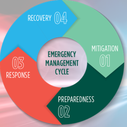
Emergency Management 101
Public Safety Canada helps Canadians and their communities protect themselves from emergencies and disasters related to all kinds of hazards – natural, human-induced and technological – through national leadership in the development and implementation of policies, plans and a range of programs.
Canadian Weather
Environment Canada website provides weather information from weather reporting stations across Canada. Links to Public Alerts, Weather Radar, Satellite, Forecasts and Air Quality are also available.
The Weather Network is a long established weather information service. Internet, television, and applications for mobile devices. It is “HIGHLY” recommended you have The Weather Network – App on your mobile device.
Wildfire Information
Public Safety Canada – Wildfire Information
In Canada, emergencies are managed first at the local and then at the provincial or territorial level; if they need help, they can ask the federal government for more resources. The Government of Canada has programs, policies, and initiatives to keep Canadians informed about the wildfire situation and to support provincial and territorial efforts to combat wildfires.
Canadian Wildland Fire Information Systems
The Canadian Wildland Fire Information System (CWFIS) creates daily fire weather and fire behavior maps year-round and hot spot maps throughout the forest fire season, generally between May and September.


